geoai
3 TopicsChoosing a real-time voice architecture on Microsoft Foundry: three enterprise patterns
A practical comparison of three real-time voice architectures on Microsoft Foundry, including implementation tradeoffs and four enterprise release gates for residency, networking, retrieval authorization, and tool credentials.902Views2likes0CommentsIntroducing Physical-World Intelligence: How GeoAI Is Helping Expand Enterprise AI
Key Takeaways Physical-World Intelligence is the ability to combine data about the physical world, such as weather, satellite imagery, infrastructure, sensors, maps, environmental conditions, and asset locations, with enterprise data and AI to support operational and business decision-making. This article argues that enterprise AI is expanding beyond documents, transactions, and digital systems to include intelligence derived from real-world conditions. The central idea is simple: organizations can make better decisions when they can perceive current real-world conditions, anticipate how those conditions may change, and connect those insights directly to workflows and actions through transforming data into information into awareness into intelligence. Physical-World Intelligence helps organizations transform data into information, information into awareness, and awareness into intelligence, enabling real-world observations to be incorporated into enterprise workflows and decisions. Why Physical-World Intelligence Matters Imagine a utility operator preparing for an approaching severe storm. Weather AI models forecast storm conditions. Satellite imagery reveals infrastructure exposure. Enterprise systems provide context about critical assets, transmission corridors, and affected communities. Together, these inputs help answer operational questions: Which assets are at risk? Where should repair crews be positioned? Which customers may be impacted? How should operations adapt before the storm arrives? These decisions require more than data. They require the capability to transform observations into intelligence that supports action. We call this capability Physical-World Intelligence. Physical-World Intelligence is the ability to combine physical-world data, enterprise data, and AI to support operational decision-making. It extends enterprise intelligence beyond traditional digital systems to include weather, infrastructure, environmental conditions, assets, and other real-world factors that influence business outcomes. Recent advances in GeoAI are making it practical to integrate these signals into operational workflows. At Microsoft Build, Microsoft introduced the Geospatial and Earth Science domain on Microsoft Foundry, creating a dedicated destination for discovering and deploying AI models designed to analyze and generate insights to help businesses understand the physical world. The initial catalog includes seven models spanning weather forecasting, Earth observation analysis, image classification, object detection, full motion video and automated map generation. These include Microsoft's Aurora, MARS (Map Auto-Regressive System), EO Object Detection, Full motion video Object Detection and FTW-PRUE, alongside NVIDIA's Earth2Studio FCN3 and StormScope forecasting models. These models represent an important milestone for GeoAI. More importantly, they demonstrate a broader shift: AI systems are increasingly able to analyze not only digital information, but also the geospatial, environmental and other dynamic physical world data. From Enterprise Intelligence to Physical-World Intelligence For decades, documents, transactions, applications, and operational systems have successfully built the foundation for enterprise intelligence. However, it is becoming more obvious that many business outcomes are influenced by factors that exist outside those systems: A utility operator needs to understand how weather affects infrastructure reliability; An insurer needs to assess changing catastrophe exposure; A retailer needs to anticipate weather-driven demand; A manufacturer needs visibility into environmental and supply-chain disruptions; A government agency needs situational awareness during natural disasters. In each case, the most important signals often originate in the physical world. Advances in Earth observation, weather forecasting, cloud computing, and AI are making it possible to systematically transform those signals into intelligence and information that organizations can use. Together, these advances are helping create a new category of enterprise capability: Physical-World Intelligence. At its core, Physical-World Intelligence enables organizations to: Perceive the World Understand current conditions across assets, infrastructure, operations, and environments using satellite imagery, weather observations, drone data, sensors, and other geospatial information. Anticipate What Happens Next Predict how conditions may evolve and allow organizations to evaluate that potential impact on their operations, resilience, planning, and business outcomes. Coordinate Effective Action Integrate intelligence and insights into workflows and business processes to support their operational planning, coordination, and decision-making. These capabilities are becoming increasingly important across energy, utilities, insurance, government, agriculture, sustainability, manufacturing, and supply-chain operations. For example, utility storm operations use all three: understanding current infrastructure conditions, anticipating weather impacts, and coordinating response activities. GeoAI: The Technology Foundation for Physical-World Intelligence Physical-World Intelligence describes the business capability. GeoAI is one of the key technologies enabling it. GeoAI combines geospatial data, Earth observation, weather intelligence, machine learning, and foundation models to generate intelligence from real-world conditions. Today's GeoAI models demonstrate several important capabilities: Capability What It Enables Example Models Perception Understanding current conditions EO Object Detection, FTW-PRUE, MARS Anticipation Forecasting future conditions and risk Aurora, Earth2Studio FCN3, StormScope Decision & Action Supporting decisions and workflows Emerging geospatial reasoning models and AI agents Perception models help organizations extract meaningful information from imagery. For example, EO and FMV Object Detection identifies objects of interest, FTW-PRUE identifies agricultural field boundaries, and MARS automatically generates map features from aerial imagery. Anticipation models help organizations forecast weather, assess risk, and evaluate how conditions may evolve. Aurora, Earth2Studio, and StormScope are examples of this capability. As GeoAI continues to evolve, the focus is shifting from individual model predictions to end-to-end decision support. Organizations increasingly want AI systems that combine physical-world observations, enterprise context, and operational workflows to help them determine not only what is happening and what may happen next, but also what actions the organization should consider next. Why Models Alone Aren't Enough The rapid advancement of GeoAI models creates significant opportunities, but models alone do not create business outcomes. Forecasting a severe storm is only part of the challenge. Organizations must still determine what it means for their assets, operations, customers, and response plans. These decisions require combining model outputs with enterprise data and operational workflows. Many organizations still face four common challenges Data Gap Physical-world data is fragmented, heterogeneous, and constantly changing. Insight Gap Observations often remain isolated in dashboards and reports instead of becoming reusable intelligence. AI Gap Data must be standardized and connected with business context before AI systems can generate meaningful insights. Action Gap Insights must ultimately connect to enterprise workflows and decision-making systems. Physical-World Intelligence cannot be delivered through data alone, models alone, or applications alone. It requires a platform that connects all three. Microsoft Planetary Computer Pro: The GeoAI Data Plane This is where Microsoft Planetary Computer Pro fits into the architecture. Planetary Computer Pro serves as the GeoAI Data Plane, connecting physical-world data, GeoAI models, and enterprise workflows into a unified operational system. Just as enterprise data platforms make business data accessible to analytics and AI systems, Planetary Computer Pro makes physical-world data accessible to GeoAI models, applications, and enterprise workflows. Planetary Computer Pro helps organizations: Build a Unified Physical-World Data Foundation Ingest, catalog, govern, and manage satellite imagery, weather data, drone imagery, LiDAR, and enterprise geospatial information. Create AI-Ready Context Transform observations and model outputs into standardized, reusable intelligence that can be consumed by analytics applications and AI workflows. Connect Intelligence to Enterprise Systems Integrate intelligence with Microsoft Foundry, Microsoft Fabric, Power BI, Copilot experiences, and partner platforms such as Esri and QGIS. Returning to the storm operations example: Microsoft Foundry provides weather forecasting and GeoAI models. Planetary Computer Pro connects those models with inferencing input data and connects output predictions with geospatial data, infrastructure information, and operational context. Enterprise systems consume the resulting intelligence to support planning and response. Microsoft Foundry provides the model ecosystem. Planetary Computer Pro helps organizations integrate those models at enterprise scale. Accelerating Adoption with the GeoAI SDK To simplify the path from GeoAI experimentation to production, we provide the GeoAI SDK—a developer toolkit that connects geospatial data managed by Planetary Computer Pro with AI models hosted in Microsoft Foundry. Running geospatial AI models at enterprise scale requires more than deploying a model endpoint. Developers need to manage large imagery collections, identify relevant data, prepare inputs, execute inference workflows, and publish results in a format that can be consumed by downstream applications. The GeoAI SDK helps streamline this workflow. Using the GeoAI SDK, developers can: Discover and deploy supported GeoAI models from Microsoft Foundry. Define areas of interest and automatically discover relevant geospatial data. Prepare imagery and execute inference workflows at scale. Manage model outputs and publish results back into Planetary Computer Pro GeoCatalog. Integrate resulting intelligence into analytics platforms, applications, and enterprise workflows. The SDK currently supports models such as EOOS Object Detection and MARS Map Generation, enabling developers to detect objects, extract infrastructure, and generate map features from satellite imagery using a consistent workflow. The goal is simple: make it easier to move from experimenting with GeoAI models to building production-scale applications that deliver physical-world intelligence. Looking Ahead The introduction of the Geospatial & Earth Science domain in Microsoft Foundry represents an important milestone for GeoAI. But the larger opportunity extends beyond geospatial models. Organizations increasingly need AI systems that understand not only digital systems, but also the dynamic physical world around them. Whether preparing for severe storms, assessing wildfire risk, monitoring critical infrastructure, optimizing supply chains, or managing environmental impacts, organizations need intelligence that begins with understanding real-world conditions. Physical-World Intelligence represents the next evolution of enterprise AI. GeoAI provides the technology foundation. Microsoft Foundry provides the model ecosystem. Microsoft Planetary Computer Pro provides organizations with the GeoAI Data Plane that helps them to integrate those capabilities into their workflows. Together, they enable organizations to move from observations, to intelligence, to action. We are excited to see what developers, architects, data scientists, partners, and customers build next. The future of enterprise AI won't only help organizations understand documents and data. It will increasingly help organizations incorporate real-world conditions into planning and decision-making. Get Started Explore the Geospatial and Earth Science domain in Microsoft Foundry Learn more about Microsoft Planetary Computer Pro | Microsoft Azure & Microsoft Planetary Computer Pro | Microsoft Learn Build applications using the GeoAI SDK695Views0likes0CommentsUnified AI Weather Forecasting Pipeline thru Aurora, Foundry, and Microsoft Planetary Computer Pro
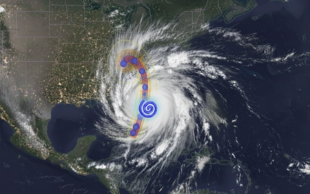
Weather shapes some of the most critical decisions we make, from protecting our critical infrastructure and global supply chains, to keeping communities safe during extreme events. As climate variability becomes more volatile, an organization’s ability to predict, assess, and plan their response to extreme weather is a defining capability for modern infrastructure owners & operators. This is especially true for the energy and utility sector — even small delays in preparations and response can cascade into massive operational risk and financial impacts, including widespread outages and millions in recovery costs. Operators of critical power infrastructure are increasingly turning to AI-powered solutions to reduce their operational and service delivery risk. “As the physical risks to our grid systems grow, so too does our technological capacity to anticipate them. Artificial intelligence has quietly reached a maturity point in utility operations-not just as a tool for optimization, about as a strategic foresight engine. The opportunity is clear: with the right data, infrastructure, and operational alignment, AI outage prediction utility grid strategies can now forecast vulnerabilities with precision and help utilities transition from reactive to preventive risk models.” – Article by Think Power Solutions Providing direct control of their data and AI analytics allows providers to make better, more actionable insights for their operations. Today, we’ll demonstrate and explore how organizations can use the state-of-the-art Aurora weather model in Microsoft Foundry with weather data provided by Microsoft Planetary Computer (MPC), an Azure based geospatial data management platform, to develop a utility industry-specific impact prediction capability. Taking Control of your Weather Prediction Microsoft Research first announced Aurora in June 2024, a cutting-edge AI foundation model enabling locally executed, on-demand, global weather forecasting, and storm-trajectory prediction generated from publicly available weather data. Two months later, Aurora became available on Microsoft Foundry elevating on-demand weather forecasting from a self-hosted experience to managed deployments, readying Aurora for broader enterprise and public adoption. Aurora’s scientific foundations and forecasting performance were peer‑reviewed and published in Nature, providing independent validation across global benchmarks. Its evolution continues with a strong commitment to openness and interoperability: In November 2025, Microsoft announced plans to open-source Aurora to accelerate innovation across the global research and developer community. Building upon the innovation and continued development of Aurora, today we are showcasing how organizations can operationalize this state-of-the-art capability with Microsoft Planetary Computer and Microsoft Planetary Computer Pro. By bringing together the vast public geospatial data stores in Planetary Computer, with the private data managed by Planetary Computer Pro, organizations can unify their weather prediction and geospatial data in a single platform, simplifying data processing pipelines and data management. This advancement allows enterprise customers to take control of their own weather forecasting on their own timeline. A Unified Weather Prediction Data Pipeline In addition, a key pain-point for energy and utility companies is the inability to reliably ingest, store, and operationalize high-volume weather data. Model inputs and outputs often sit scattered across fragmented pipelines and platforms, making decisions difficult to trace, reproduce, and reference over time. For example, referenced in articles, many utility companies have to pull public data from various silos, maintain GIS layers in another, and run operational planning in a separate environment—forcing teams to manually stitch together forecasts, assets, and risk assessments, introducing delays exactly when rapid decisions matter most. With the MPC Pro + Microsoft Foundry pipeline, utility companies transition from fragmented, manual workflows to a single operating platform – where the value lies in a seamless end-to-end data-to-model pipeline. Users can leverage Aurora on Microsoft Foundry alongside Microsoft Planetary Computer Pro’s geospatial data platform to unlock the following unified workflow: Source near real time weather data from Planetary Computer Run Aurora in Microsoft Foundry Fuse weather prediction results with geospatial data in Planetary Computer Pro for rapid assessment and post processing A Ready-to-use reference architecture This reference architecture provides a reusable pattern for operationalizing frontier weather models with Microsoft Planetary Computer Pro and Microsoft Foundry. Our architecture feeds updated global weather data, hosted by Microsoft Planetary Computer, to the Microsoft Foundry hosted model, then fuses those prediction results with enterprise geospatial context for analysis, decision-making, and action. Each component plays a distinct role in ensuring forecasts are timely, scalable, and directly usable within operational workflows. Near Real-Time Weather Data Microsoft Planetary Computer automatically ingests, indexes, and distributes up-to-date global weather data from the European Centre for Medium-Range Weather Forecasts (ECMWF) four times per day. This fully managed data pipeline ensures that the latest atmospheric datasets are continuously refreshed, standardized, and readily accessible, eliminating the need for manual data acquisition or preprocessing. Storing and Centralizing Public and Private Geospatial Data on Microsoft Planetary Computer Pro Microsoft Planetary Computer Pro enables utility operators to store, manage, and access both public and private geospatial datasets within a single Azure platform. With a Microsoft Planetary Computer Pro GeoCatalog, organizations can centralize ECMWF weather data alongside infrastructure and location data to support downstream analyses. Microsoft Foundry Hosts and Runs Weather Prediction Model on Demand Microsoft Foundry provides model access and the infrastructure required to support execution of Aurora and other weather forecasting models. Users can provision Aurora inference endpoints on their own dedicated compute. After provisioned, the user would be able to open the python notebook and run the model to execute weather forecasts on demand. Weather Forecast Outputs are Fused with Existing Data Sources on Microsoft Planetary Computer Pro Aurora’s weather prediction outputs are seamlessly integrated back into Microsoft Planetary Computer Pro, where they are fused with existing public or private geospatial datasets. This makes forecast results immediately accessible for visualization, post-processing, and analysis—such as identifying assets at risk, estimating localized impact, informing operational response plans, or pre-positioning needed assets for quick recovery. By combining AI-driven forecasts with geospatial context, organizations can move from raw predictions to actionable insights in a single workflow. This solution also provides organizations with a centralized platform to store and catalog geospatial data for future traceability. Unified Weather Prediction Demonstration This demonstration visualizes the forecast storm track (Figure 2), along with projected damage impact along the storm path and associated coastal surge areas (Figure 3 & 4). This enables users to assess asset exposure, anticipate damage due to winds, pre-position crews, and proactively protect critical infrastructure—helping reduce outage duration, lower operational costs, and improve grid resilience. & Powerplants) Getting Started The python notebook supports tracking of historical storm events, forecasting real-time storm trajectories, and overlaying critical power infrastructure structure data from OpenStreetMap to visualize overlap. To get started, deploy this solution in your Azure environment to begin generating weather forecasts and storm-track predictions. The code and documentation for running this notebook are available in the linked GitHub Repo. Sample output for you to explore are linked within this HTML. For additional resources, visit the following MS Learn pages: Microsoft Planetary Computer Pro Microsoft Foundry The interoperability between ‘GeoAI models + data platform’ extends far beyond weather prediction. It empowers organizations to take control of their geospatial data; to generate actionable insights on their own timeline, and to meet their own specific needs. With Microsoft Planetary Computer and Microsoft Foundry together, organizations will unify their enterprise geospatial data, and unlock its value with powerful, and state of the art AI solutions.2KViews4likes0Comments